CASCADES: A Journey Along Greenland’s Coast Where Ocean Meets Ice
NASA Science ·
CASCADES is an international, multidisciplinary expedition bringing together glaciologists, marine-mammal observers, microbiologists, geologists, and biogeochemists. The post CASCADES: A Journey Along Greenland’s Coast Where Ocean Meets Ice appeared first on NASA Science .
By Simon Bélanger, Université du Québec à Rimouski (UQAR), Québec, Canada
What an extraordinary feeling it is to witness the beauty of these icy landscapes, where the ice sheet flows down to the sea through fjords with steep, towering walls—watching, in real time, as the ice sculpts this raw, mineral landscape… Breathtaking!
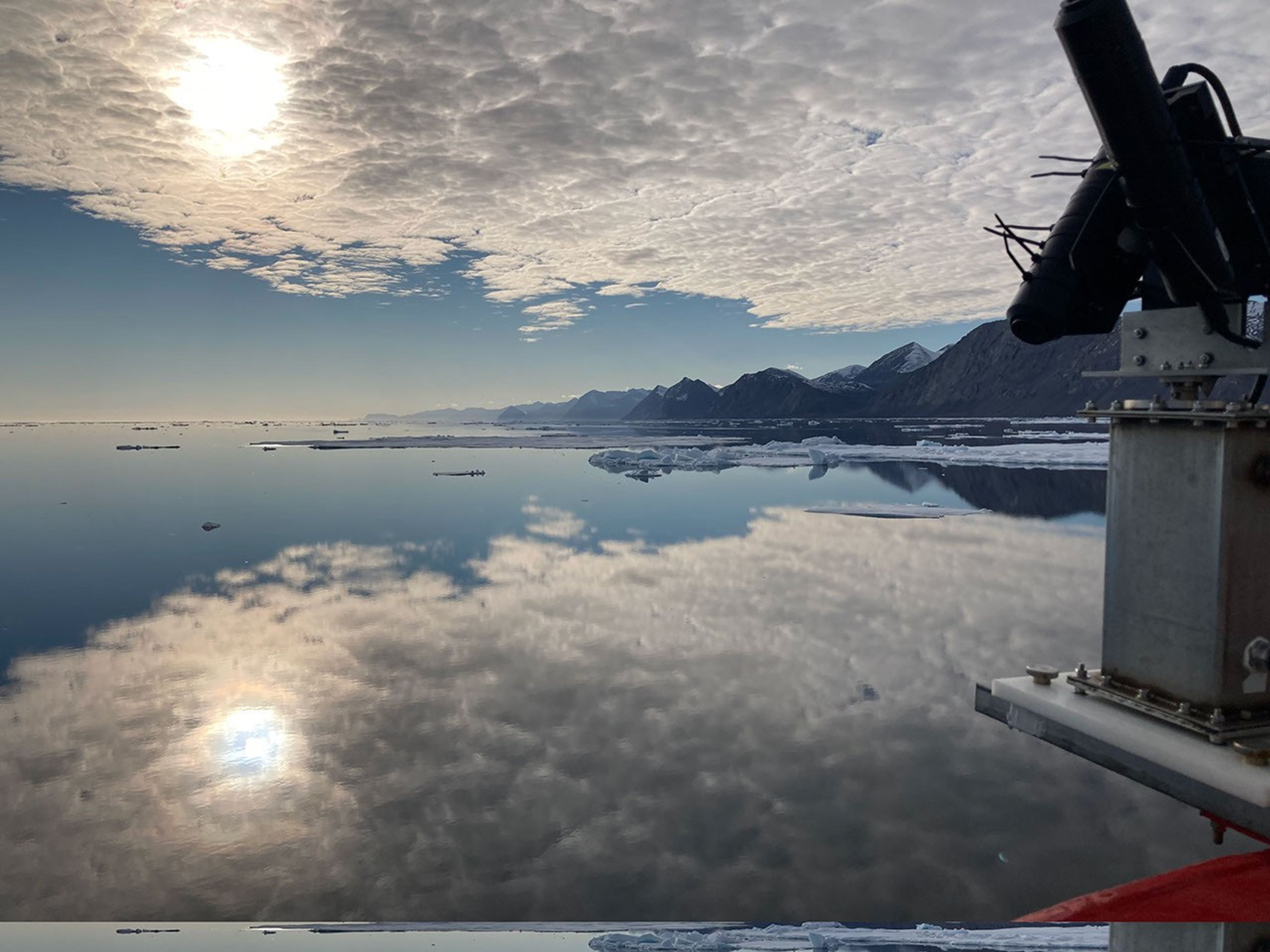
The pySAS solar tracking instrument is deployed in the Kennedy Channel between Greenland and Ellesmere Island. Simon Bélanger
The Canadian Coast Guard Ship (CCGS) Amundsen, an icebreaker, sails near the community of Kullorsuaq, Greenland. Amundsen Science/Véronique Rochefort
Petermann Ice Island drifts in the Robeson Channel. Simon Bélanger
We all know that Greenland’s glaciers are melting fast in response to global warming. But how that meltwater changes the surrounding ocean is still largely unknown, since field observations here are scarce and sailing among sea ice and icebergs is challenging and costly. From August 6 to September 3, 2026, I had the rare opportunity to join the CASCADES (a ‘thematic’ name, not an acronym) expedition, sailing more than 3,000 nautical miles (5,500 kilometers) to reach the Robeson Channel. This body of water runs between Ellesmere Island and Greenland at 82°N, where cold water and sea ice flow south out of the Arctic Ocean. Along the way, we collected oceanographic measurements in fjords and near settlements with names as striking as the landscapes themselves—Ilulissat (Jakobshavn), Uummannaq, Kullorsuaq, Petermann, and Qaanaaq (Thule)—places where ocean, ice, and meltwater interact.
Simon Bélanger poses in front of the Jakobshavn Glacier. Jonathan Gagnon
Meltwater is sampled in front of the Upernavik Glacier by the chief scientist, Jean-Éric Tremblay, and Lucie Mallard. Amundsen Science/Véronique Rochefort
As an ocean-color remote-sensing specialist, my job on board was to measure how sunlight interacts with the water and its constituents—the same frequency of light (wavelength) NASA’s PACE (Plankton, Aerosol, Cloud, ocean Ecosystem) satellite measures from space—and to collect water samples to identify the tiny drifting algae, or phytoplankton, and non-living suspended matter that give the ocean its colorful aspect. These measurements will help validate what PACE measures from orbit. But CASCADES is much bigger than my own work: it is an international (Canada, Switzerland, France, and Greenland), multidisciplinary expedition bringing together glaciologists measuring ice thickness, marine-mammal observers, microbiologists, geologists, and biogeochemists. Together, we are trying to understand how carbon and nutrients move from the ocean’s surface to the deep sea, and how glacier meltwater changes that journey.
This map shows the sampling voyage, using PACE imagery and photographs. NASA PACE-OCI/Carina Poulin
No two days aboard the CCGS Amundsen were alike. Our operations ranged from water sampling with a CTD rosette (an instrument that measures temperature, salinity, and depth), to catching zooplankton and fish with nets, to pulling up surface sediments and six-meter-long sediment cores that let us reconstruct the history of these fjords. And, of course, I had my own work: measuring how light travels through the water column at different wavelengths across the visible spectrum and taking water color spectra at the surface. These water color spectra tell us about the abundance of biological activity and possibly about the composition of the phytoplankton communities that form the base of the marine ecosystems.
Water sampling with the CTD rosette takes place at a land-terminating glacier (Ukkusissat) near Uummannaq Fjord. Jonathan Gagnon
The CCGS Amundsen icebreaker sits just offshore in Kullorsuaq, Greenland. Simon Bélanger
Near the community of Kullorsuaq, Greenland, a hyperspectral instrument (pySAS) measures water color to validate PACE observations. Université du Québec à Rimouski/Simon Bélanger
Juliette Provencher filters seawater under green light in the filtration lab. Jonathan Gagnon
The CASCADES expedition is led by Jean-Éric Tremblay of Université Laval, with funding from Amundsen Science, l’Institut Nordique du Québec (INQ), the Swiss Polar Institute (SPI), and the Transforming Climate Action (TCA) initiative. My remote sensing work is supported by the Canadian Space Agency (CSA).
Frazil ice forming at the sea surface is observed with polarized light filtering. Jonathan Gagnon
Petermann Fjord is located at 81.5°N. Jonathan Gagnon
The post CASCADES: A Journey Along Greenland’s Coast Where Ocean Meets Ice appeared first on NASA Science .