CSDA Vendor – Satlantis
NASA Science ·
Satlantis’s GEISAT constellation, comprising the GEISAT‑P and HORACIO satellites, provides high–spatio‑temporal methane (CH₄) observations with simultaneous emitter geolocation. Each satellite simultaneously acquires co‑registered visible and near‑infrared (VNIR) and shortwave infrared (SWIR) imagery, allowing accurate attribution of detected plumes, providing straightforward identification of the emission sources. In addition to methane detection, the synchronized VNIR–SWIR imagery supports […] The post CSDA Vendor – Satlantis appeared first on NASA Science .
CSDA Commercial Data Available Datasets End User License Agreements Commercial Satellite Data Explorer Satellite Data Evaluation CSDA Vendors Airbus BlackSky Capella GeoOptics GHGSat ICEYE MDA Space Orbital Sidekick OroraTech Pixxel Planet PlanetiQ Polar Geospatial Center Satellogic Satlantis Spire Teledyne Brown Engineering Tomorrow.io Umbra Vantor Wyvern Program Activities Learning Resources FAQs News News and Events Subscribe to CSDA Orbit CSDA Vendor – Satlantis NASA’s Commercial Satellite Data Acquisition (CSDA) program has acquired commercial datasets from Satlantis.
Satlantis’s GEISAT constellation, comprising the GEISAT‑P and HORACIO satellites, provides high–spatio‑temporal methane (CH₄) observations with simultaneous emitter geolocation. Each satellite simultaneously acquires co‑registered visible and near‑infrared (VNIR) and shortwave infrared (SWIR) imagery, allowing accurate attribution of detected plumes, providing straightforward identification of the emission sources.
In addition to methane detection, the synchronized VNIR–SWIR imagery supports a broad range of Earth observation applications. The constellation’s high revisit frequency and fine spatial resolution offer continuous monitoring of vegetation dynamics and land‑cover change. These measurements benefit a range of science and applications use cases including wildfire monitoring, precision agriculture, and coastal monitoring (e.g., harmful algal bloom detection) and more.
All newly awarded commercial data provider products are currently undergoing CSDA evaluation. If you have any questions about these products, please email CSDA Support .
Data products and derivatives for imagery must contain copyright markings as specified below, where YYYY is the year of the image acquisition.
To help CSDA identify your publications, we request that you include the following acknowledgment when publishing work created using CSDA program data:
“This work utilized data made available through the NASA Commercial Satellite Data Acquisition (CSDA) Program.”
Authorized users should send CSDA a courtesy copy of any publications that include CSDA-provided data.
Access to this data is governed by the CSDA End User License Agreements ( EULAs ). The minimum access level for data is the USG license. Depending on the specific data products provided, some or all data may also be available under higher-tier CSDA licenses, including USG‑Plus and Public licenses.
Under the applicable license tier, authorized users may include:
All data use must comply with the terms of the EULA. All data requests must be reviewed and approved by NASA’s Commercial Satellite Data Acquisition (CSDA) program.
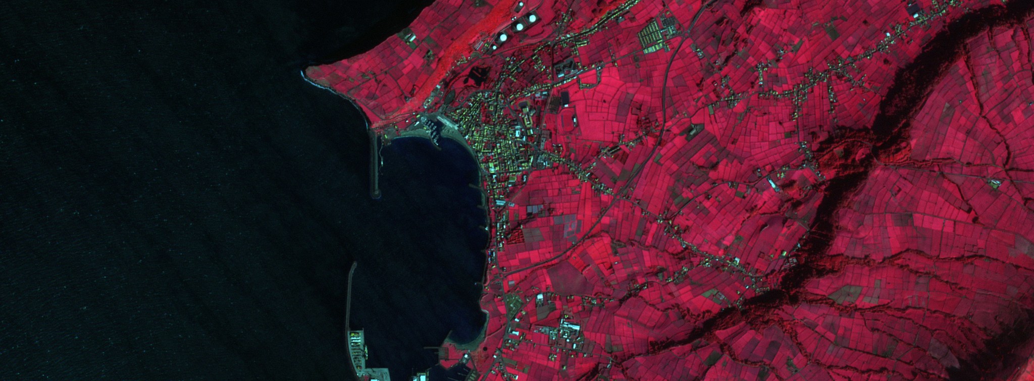
Top Banner Image: Color-infrared composite (NIR, red, green) satellite image of Praia da Vitória and its harbor on Terceira Island, Azores, acquired at 1.8 m resolution by Satlantis GEISAT on 15 February 2026. Vegetated farmland appears bright red, the Atlantic and harbour basin near black, and built-up surfaces cyan and olive. Credit: © Satlantis 2026. All rights reserved.
The post CSDA Vendor – Satlantis appeared first on NASA Science .